Ancient Merv, near the modern city of Mary in southeastern Turkmenistan, was once one of the largest cities on earth. At its 12th-century peak under the Seljuk Turks it may have held over half a million people, and medieval Arab and Persian writers called it “the mother of the world” and “the pearl of the East” — a hub on the Silk Road connecting China, Persia and the Mediterranean. Genghis Khan’s son Tolui razed it in 1221 in one of the deadliest single sackings in recorded history. What remains is a UNESCO World Heritage Site spread across roughly a thousand hectares — one of the largest and best-preserved oasis-city archaeological landscapes anywhere on the Silk Road.
Ancient Merv at a glance
| Location | About 30 km west of Mary, southeastern Turkmenistan |
|---|---|
| UNESCO status | World Heritage Site since 1999 |
| Peak period | 11th–12th century, under the Seljuk Empire |
| Site size | Roughly 1,000 hectares across several successive walled cities |
| Destroyed | 1221, by the Mongol army under Tolui |
| Key structures | Mausoleum of Sultan Sanjar, Kyz Kala fortresses, Greater and Lesser Kyz Kala, the Erk Kala citadel |
What it is like to walk through it
Merv is not one ruin but several cities layered next to each other, built and abandoned in succession over more than a thousand years — Erk Kala from the Achaemenid period, Gyaur Kala from Sassanian and early Islamic times, and Sultan Kala, the Seljuk city, where most of the standing monuments are. The scale is what stays with people: you can stand on the eroded mudbrick ramparts of Erk Kala and see kilometres of open desert dotted with the outlines of walls, towers and domes in every direction, with almost no other visitors and no barriers between you and the structures.
The Mausoleum of Sultan Sanjar dominates the site — a restored 12th-century domed tomb that was, in its time, one of the largest mausoleums in the Islamic world. Nearby, the two Kyz Kala structures (“Maiden’s Castle”) show the distinctive corrugated mudbrick walls typical of pre-Islamic Central Asian palace architecture, unlike anything else on a standard Silk Road itinerary.
Why it mattered
Merv sat at the point where the main Silk Road route from China split toward Persia, Mesopotamia and the Mediterranean, and its irrigated oasis on the Murghab River supported a population that, under the Seljuks, rivalled Baghdad and Cairo. It was a centre of Islamic scholarship with major libraries, and the 1221 destruction — often cited alongside the sack of Baghdad as among the deadliest events of the Mongol conquests — is why the site was abandoned rather than continuously rebuilt, leaving the archaeological layers intact for the UNESCO listing eight centuries later.
How to get there
The nearest city is Mary, reachable by domestic flight from Ashgabat or by road as part of a cross-country itinerary — Merv sits on the route between Ashgabat and the Uzbek border crossing at Farap, which makes it a natural stop on any tour linking Turkmenistan with Khiva or Bukhara. Most of our itineraries that include Merv pair it with a night in Mary and a half or full day exploring the site, since distances between the different walled cities within Merv are too large to cover on foot alone.
When to go
Spring and autumn again give the most comfortable conditions — the site is entirely open desert with no shade, and summer afternoons regularly exceed 40°C. An early morning start is the standard approach even outside summer, both for the light and for comfort walking between the different city zones.
What else is nearby
- Yangykala Canyon — the striped desert canyon further west, usually combined with Merv on longer routes toward Dashoguz.
- Darvaza gas crater — reachable via Ashgabat as part of the same west-to-east or east-to-west crossing.
- The Farap border crossing — the usual continuation point toward Bukhara for guests combining Turkmenistan and Uzbekistan.
Ancient Merv is included on most of our multi-day Turkmenistan itineraries that cross the country east–west. See our Turkmenistan tour packages or the routes built specifically for travellers crossing from Uzbekistan on our Khiva departures page.
Frequently asked questions
 3 days
 4 days
4-Day Ashgabat, Darvaza & Kow-Ata Tour
from $595 per person
guaranteed departure
Itinerary and prices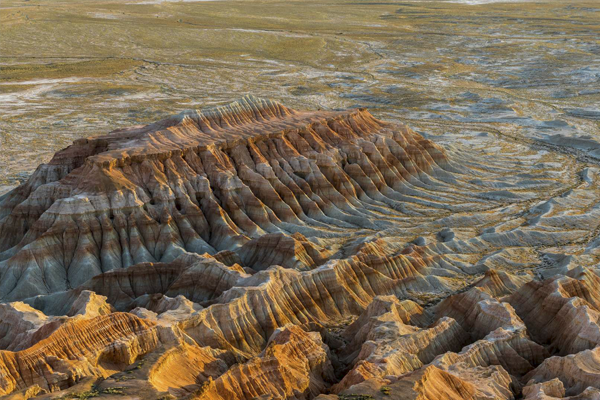 5 days
5-Day Ashgabat, Darvaza, Yangykala & Kow-Ata Tour
from $760 per person
guaranteed departure
Itinerary and prices6-Day Nature & Landscape Tour of Turkmenistan
from $890 per person
guaranteed departure
Itinerary and prices 7 days
7-Day Turkmenistan Discovery Tour | Ashgabat, Yangykala & Darvaza
from $975 per person
guaranteed departure
Itinerary and prices 8 days
How much time do you need at Ancient Merv?
A half day covers the main highlights — the Sultan Sanjar Mausoleum and the Kyz Kala fortresses — while a full day allows time to also reach the more remote Erk Kala and Gyaur Kala zones. Given the site’s size, getting between areas by vehicle is normal rather than walking the whole thing.
Is Ancient Merv the same as the modern city of Mary?
No. Mary is the modern regional city, about 30 km east of the archaeological site. Ancient Merv is the ruined city itself, abandoned since the 13th century, and Mary functions as the base for visiting it.
Is there shade or shelter on site?
Very little. The site is open desert with scattered ruins and no visitor infrastructure beyond a small museum area, so sun protection, water and a hat are essential, particularly outside the spring and autumn months.
Why is Merv less visited than Bukhara or Samarkand?
Partly because it was never rebuilt after the Mongol destruction, so there is no living old town around it the way there is in Bukhara — Merv is purely archaeological. It is also inside Turkmenistan, which sees far fewer visitors than Uzbekistan due to the more involved visa process, which is exactly why the site remains so uncrowded.
Can Ancient Merv be combined with a trip to Bukhara or Khiva?
Yes — it is a natural stop on itineraries that cross between Turkmenistan and Uzbekistan via the Farap border, and we build routes specifically to combine Merv with Khiva or Bukhara on either side of the crossing.
What should I bring for a visit?
Sturdy walking shoes for uneven mudbrick and sand, sun protection, water, and a camera — the scale of the ruins and the near-total absence of other visitors make it one of the more photogenic stops on a Turkmenistan itinerary.
